
TOPICS COVERED
- DEFINITIONS AND BRIEF DESCRIPTION OF SURVEYING
- SURVEYING AND ITS CLASSIFICATION
- SURVEYING AND ITS HISTORY
- LATEST TRENDS OF SURVEYING
- ERRORS IN MEASUREMENT
- TYPES OF ERRORS
- ACCURACY AND PRECISION OF MEASUREMENTS
- NATURE OF RANDOM ERRORS
- MEASURES OF PRECISION
- PROPAGATION OF RANDOM ERRORS
- ERROR OF A SERIES AND A MEAN
- WEIGHTS OF MEASUREMENTS
- MEASUREMENT OF HORIZONTAL DISTANCES
- METHODS OF MEASURING HORIZONTAL DISTANCES
- CHAINING AND TAPING ACCESSORIES
- MEASUREMENT BY CHAIN
- REDUCTIONS TO MEASUREMENT IN SLOPES
- SYSTEMATIC ERRORS IN LINEAR MEASUREMENT BY CHAIN OR TAPE
- RANDOM ERRORS
- CHAIN AND TAPE SURVEY OF A FIELD
- ERROR IN OFFSET
- ELECTRONIC DISTANCE MEASUREMENTS
- BASIC CONCEPTS OF ELECTRONIC DISTANCE MEASUREMENTS
- CLASSIFICATION OF ELECTROMAGNETIC RADIATION
- COMPUTING THE DISTANCE FROM THE PHASE DIFFERENCES
- BRIEF DESCRIPTION OF DIFFERENT TYPES OF INSTRUMENTS
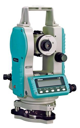
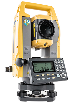
- TOTAL STATION INSTRUMENTS
- EFFECTS OF ATMOSPHERIC CONDITIONS ON WAVE VELOCITY
- INSTRUMENTAL ERRORS IN EDM
- REDUCTION OF SLOPE MEASUREMENTS IN EDM
- LEVELLING AND ITS BASIC CONCEPTS
- CURVATURE AND REFRACTION
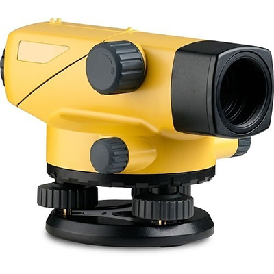
- LEVELLING INSTRUMENTS
- CLASSIFICATION OF SURVEYING TELESCOPE
- LENS FORMULA
- ENGINEER’S LEVELS
- TILTING LEVEL
- AUTOMATIC OR SELF-LEVELLING LEVEL
- OPTICAL TERMS AND DEFECTS
- THE LEVELLING STAFF
- PARALLEL PLATE MICROMETER
- TEMPORARY ADJUSTMENTS OF A DUMPY LEVEL
- TERMS USED IN LEVELLING
- DIFFERENT METHODS OF LEVELLING
- DIFFERENTIAL LEVELLING
- LEVEL BOOK
- CHECKING OF LEVELS
- ERRORS IN LEVELLING
- REDUCING ERRORS AND ELIMINATING MISTAKES IN LEVELLING
- COLLIMATION CORRECTION
- CHECK LEVELLING
- FLY LEVELLING
- PROFILE LEVELLING
- CROSS SECTIONAL LEVELLING
- RECIPROCAL LEVELLING
- TWO PEG TEST
- THREE WIRE LEVELLING
- ERROR, ADJUSTMENT AND PRECISION OF LEVEL
- PERMANENT ADJUSTMENTS OF LEVELS
- ANGLES AND DIRECTIONS
- BEARINGS AND AZIMUTHS
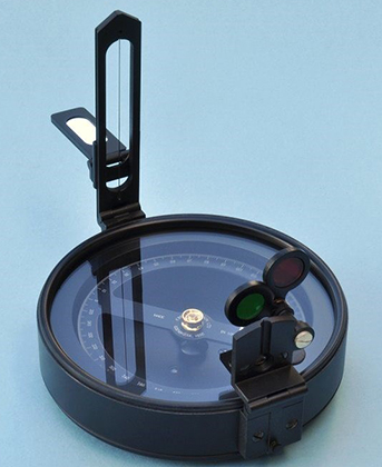
- COMPASS SURVEYING
- PRISMATIC, SURVEYORS AND TROUGH COMPASSES
- COMPASS TRAVERSE
- ERRORS IN COMPASS SURVEYING
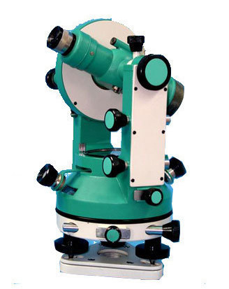
- THEODOLITES
- VERNIER THEODOLITE
- PLANES AND LINES OF A THEODOLITE
- TRAVERSE SURVEY AND COMPUTATIONS
- CLOSED TRAVERSE
- ANGLE MISCLOSURE
- RECTANGULAR COORDINATES
- GALE’S TRAVERSE TABLE
- CURVES
- INTERSECTION OF A LINE AND CIRCLE
- TRANSITION CURVE
- CENTRIFUGAL RATIO
- IDEAL TRANSITION CURVE
- VERTICAL CURVES
- GENERAL EQUATIONS OF A PARABOLIC CURVE
- DESIGN OF A VERTICAL CURVE
- SIGHT DISTANCE OF A VERTICAL CURVE
- AREAS AND VOLUMES
- METHODS OF MEASURING AREA
- VOLUME THROUGH TRANSITION
- SIMPSON’S CUBATURE FORMULA
- MASS HAUL CURVE
- TACHEOMETRY
- DIFFERENT TYPES OF TACHEOMETRIC MEASUREMENTS
- STADIA METHOD
- MOVABLE HAIR METHOD
- SUBTENSE BAR
- PROBLEMS IN PRACTICAL APPLICATION OF TANGENTIAL METHOD
- ERRORS IN TACHEOMETRIC SURVEYING
- USES OF TACHEOMETRY
- ERRORS IN PLANE TABLE
- PLANE TABLE SURVEYING
- TOPOGRAPHICAL SURVEYING
- ERRORS IN TOPOGRAPHICAL SURVEYS
- PLOTTING OF CONTOURS
- CONSTRUCTION SURVEYING
- EQUIPMENTS FOR SETTING OUT
- HORIZONTAL AND VERTICAL CONTROL
- UNDERGROUND SURVEYS
- COMPUTER PROGRAMS IN SURVEYING
SURVEYING – Surveying is basic to engineering Before any engineering work can be started we must prepare a plan or map of the are showing topographical details . This involves both horizontal and vertical measurements.
Engineering Surveying is defined as those activities involved in the planning and execution of surveys for the location , design , construction , operation and maintenance of civil and other engineering projects
SURVEYING MADE EASY GATE NOTES : CLICK HERE
The surveying activities are
1. Preparation of surveys and related mapping specifications .
2. Execution of photogrammetric and field surveys for the collection of required data including topographic and hydrographic data,
3. Calculation, reduction and plotting of survey data for use in engineering design .
4. Design and provision of horizontal and vertical control survey networks
5. Provision of line and grade and other layout work for construction and training activities, thus the scope of surveying is very wide and interdisciplinary in character . Basically it involves accurate measurements and accurate computations . In surveying we use modern sophisticated instruments , example, electronic instruments for measurements and modern computational tools, example, computers for accurate mathematical computations . Hence thorough knowledge of basic science – say physics and mathematics – is required in grasping modern surveying.
SURVEYING ACE GATE EXAM NOTES : CLICK HERE
CLASSIFICATION OF SURVEYING – Surveying is very old profession and can be classified in many different ways
Classification based on Accuracy of work :
Two general classifications of surveys are geodetic and plane. In geodetic surveying the curvature of the earth is taken into account . Surveys are conducted with a high degree of accuracy . However in plane Surveying, except for leveling, the reference base for field Work and computations is assumed to be a na horizontal surface. The error caused by assuming the earth to be a plane area is not serious if the area measured is small say within 250 km
SURVEYING ACE GATE STUDY MATERIAL : CLICK HERE
Classification based on use or purpose of resulting maps
- Control surveys establish a network of horizontal and vertical points that serve as a reference framework for other surveys.
- Topographic surveys show the natural features of a country such as rivers, streams, lakes, forests, hills, etc.
- Land , boundary or cadastral survey ‘ s establish property lines and corners
- Hydrographic sures define the shore lines and depth of water bodies, e.g. oceans, reservoirs and lakes .
- Route surveys are done as a preliminary to construction of roads and railways .
- Mine surveys are done above and below the ground to guide mining operations underground
Classification based on equipments used : In chain , theodolite, plane table, tacheometric surveys , the equipment named is the major equipment used in survey work . In photogrammetric surveying, major equipment is a photogrammetric camera
SURVEYING IES MASTER GATE STUDY MATERIAL : CLICK HERE
Classification Based on Position of instruments : When measurement is done on the ground by say chain, tape or electronic distance measuring equipments it is ground survey, when photographic observations are taken from air, it is aerial survey.
FUNDAMENTALS OF SURVEYING TEXTBOOK CIVILENGGFORALL
DOWNLOAD NOW : CLICK HERE
PASSWORD : CivilEnggForAll
OTHER USEFUL BOOKS
- RAJASTHAN STAFF SELECTION BOARD (RSSB) JUNIOR ENGINEER DIPLOMA CIVIL ENGINEERING EXAM 2022 – HINDI & ENGLISH MEDIUM SOLVED PAPER – FREE DOWNLOAD PDF (CivilEnggForAll.com)
- ISRO TECHNICAL ASSISTANT EXAM 2022 – CIVIL ENGINEERING – HINDI & ENGLISH MEDIUM – SOLVED PAPER – FREE DOWNLOAD PDF (CivilEnggForAll.com)
- MADHYA PRADESH PUBLIC SERVICE (MPPSC) COMMISSION – ASSISTANT ENGINEER EXAM – MPPSC AE 2021 CIVIL ENGINEERING – SOLVED PAPER WITH EXPLANATIONS – PDF FREE DOWNLOAD
- BIHAR PUBLIC SERVICE COMMISSION (BPSC) ASSISTANT ENGINEER EXAM – 2022 – CIVIL ENGINEERING – SOLVED PAPER – FREE DOWNLOAD PDF (CivilEnggForAll.com)
- ODISHA PUBLIC SERVICE COMMISSION – OPSC AEE PANCHAYATI RAJ EXAM 2021 – SOLVED PAPER WITH EXPLANATION – FREE DOWNLOAD PDF